Home /
Florence Travel Tips / Maps / Historical Map of Florence
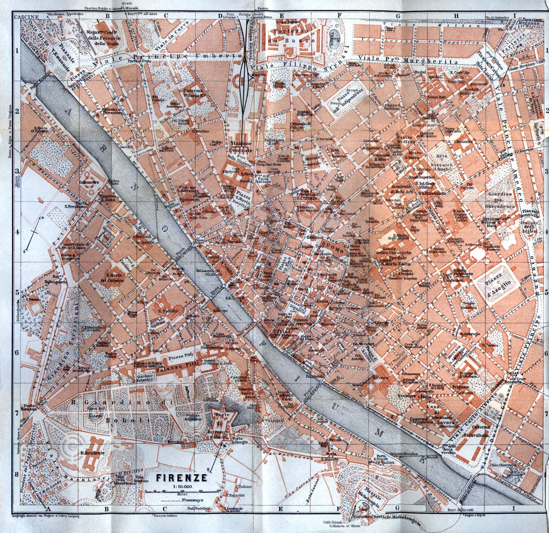
Historical Map of Florence
This is a really interesting map, taken from Baedeker's Northern Italy Handbook For Travellers, by Karl Baedeker, Fourteenth Remodelled Edition 1913 (this title is mentioned several times in the film "A Room With a View" and was integral to the "Grand Tour").
In the link above there is an audio book sample where you can here a mention of the electric trams that you can see on this map - these trams were running if Florence over 100 years ago!
Map scan courtesy of the The Perry-Castañeda Library Map Collection at the University of Texas.
Comments:
By Anthony Finta, last updated:
What's New?
-

Museum of San Marco
Jul 12, 2026
-

Calcio Storico 2026
Jun 2, 2026
-

Mille Miglia
Jun 2, 2026
-

Orsanmichele
Apr 28, 2026
-

Official Florence Museum Websites
Apr 27, 2026
-

Museo Novecento
Apr 20, 2026
-

Trattoria Sabatino
Apr 10, 2026
© 2005-2026 florence-on-line.com | About | Glossary | Newsletter | Site Map
Some links to external websites may be affiliate links (hotel bookings, guide books, activities, etc.). Using these services helps to support our efforts here with no additional costs to the user (you!).
Some links to external websites may be affiliate links (hotel bookings, guide books, activities, etc.). Using these services helps to support our efforts here with no additional costs to the user (you!).