Florence Bus Station Map
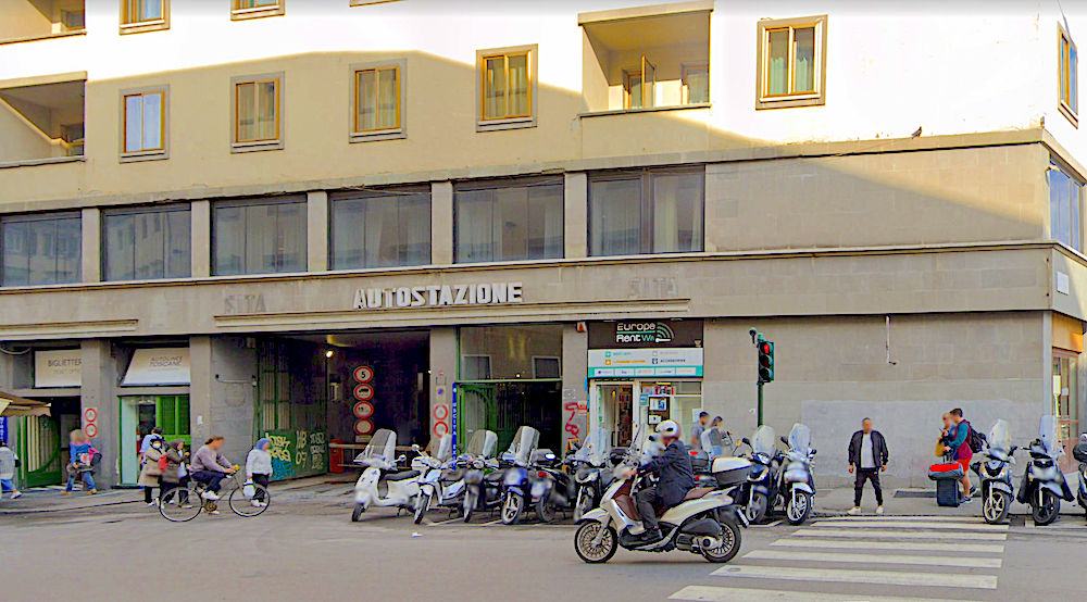
At some time in late 2021 the bus system for Florence and the region of Tuscany changed over to Autolinee Toscane. The old SITA bus depot (called the "FIRENZE AUTOSTAZIONE" in Italian) on via Santa Caterina, close to Firenze SMN (the train station) is now used by Autolinee Toscane, and is still the location for many regional buses, like the line to Siena, but the local Florentine buses have beginning and end points at their various stops throughout Florence - not at this station.
It appears most of the sites below are no longer active and/or just place holders for the former companies.
Unfortunately the Autolinee Toscane website does not have route maps, just a very annoying system of timetables - but that is where you can find information on all of the local lines.
Here are some important links for rail and bus transportation into and out of Florence and the surrounding area:
- Trenitalia: https://www.trenitalia.com This is the main train company in Italy
- Italo: https://www.italotreno.it Are high speed only trains with limited (but still substantial and covering all the major cities) lines
- Autolinee Toscane: https://www.at-bus.it The bus company that took over for ATAF and others, locally and regionally in Florence and Tuscany.
ATAF: http://www.ataf.net- SITA (Busitalia): http://www.fsbusitalia.it the only service they have remaining in Tuscany is The Mall bus
CAP: http://www.capautolinee.it (Prato, I Gigli)Lazzi: http://www.lazzi.it (Arezzo, Lucca, Montecatini Terme, Prato, Viareggio)Piubus: http://www.piubus.it
And here is a map showing the location of the autostazione:
Comments:
By Anthony Finta, last updated:
What's New?
-

San Miniato al Monte
Aug 1, 2026
-

Rifrullo Firenze
Jul 31, 2026
")
-

Mass Hours for Florence Churches
Jul 30, 2026
-

Antica Mescita San Niccolò
Jul 30, 2026
-

Uffizi Gallery
Jul 29, 2026

-

Firenze Rifredi Train Station
Jul 23, 2026
-

Pisa Airport to Florence
Jul 22, 2026
-

Florence Luggage Storage
Jul 22, 2026